Basic Info.
Model NO.
FBUAV-01
Specification
packing size 136 * 42 * 59 cm
Trademark
non
Origin
China
HS Code
8806100000
Production Capacity
3000
Product Description
| MTOW | 11.5kg |
| Weight without battery and payload | 5kg |
| Wingspan | 2,430 mm |
| Length | 1,450 mm |
| Max payload (battery included) | 6.5kg |
| Battery weight (Tattu 6S 22000mAh) | 4.72kg |
| Suggested max payload weight | 1,500g |
| Endurance | 134 minutes / 155KM (600g payload / 2 x Tattu 6S 22000mAh lipo) |
| Suggested cruise speed | 68.4-72km/h |
| Max speed | 120km/h |
| Stall speed | 36km/h |
| Anti-wind capability | 38km/h |
| Operating Altitude(Max.) | 3500m ASL |
| Material | EPO, Aluminum-plastic Film, PVC |
| Take-off / Landing | VTOL |
| Working Voltage | 12S |
| Working Temperature | -10ºC-40ºC |
| Package size | 125 * 34 * 49 cm |
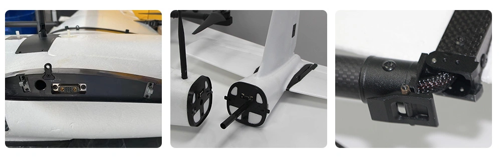
Fast deploy
Due to its modular airframe and foldable motor arm design, a single man can set up mapping VTOL in less than 3 minutes.
Long Endurance
The survey drone can fly up to 112 minutes with a 6S 22000mAh lipo battery carrying one 600g payload.

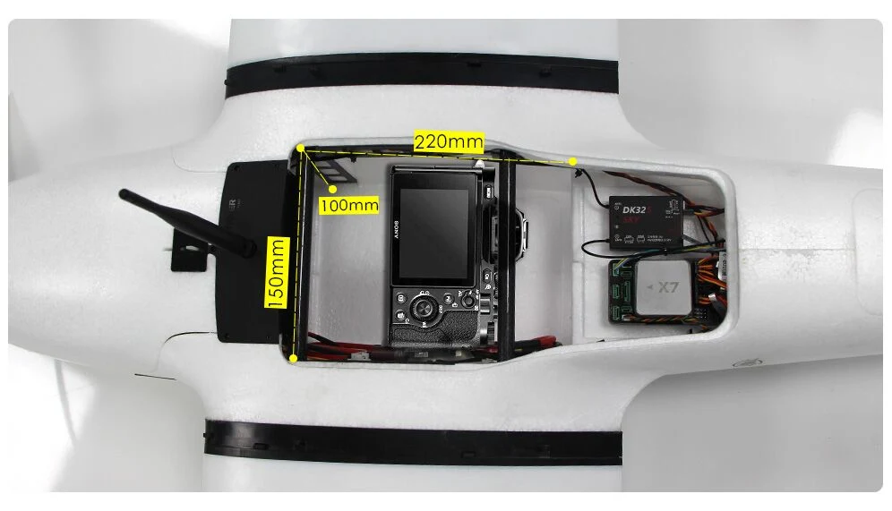
Big inner space for payload
The mapping UAV has a big internal space to accommodate various mapping cameras like SONY RX1R-II/A7R/A6000/A5100 camera and oblique camera.
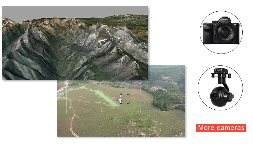
 Versatile airborne platform
 Thanks to its excellent stability and powerful payload-lift capability, VTOL can carry both mapping cameras and surveillance gimbal cameras to carry out mapping, search, rescue, and surveillance applications.
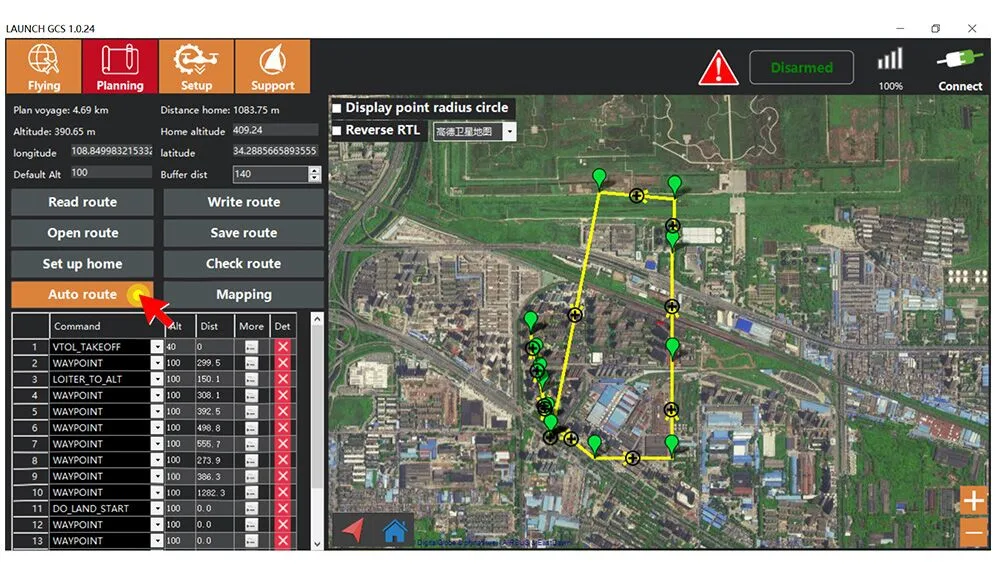
No piloting skills needed
The LAUNCH ground control software that VTOL drone uses is designed for beginners, so a pilot without any flight experience can fly the drone well.

What is included
1 x airframe (with landing gear)
4 x Lift motor
4 x Lift motor ESC
4 x Lift motor propeller
1 x Fixed-wing motor
1 x Fixed-wing motor ESC
1 x Fixed-wing propeller
4 x Wing servo
1 x CAN air Speedometer
1 x Pixhawk Cube Orange Standard Set With Here 3 GNSS
1 x WFLY ET10 radio controller
1 x Assembly and Flight Test Service
1 x Aviation transportation box
1 x LAUNCH ground control software
Items compatible (not included)
Flight controller: CUAV V5+, CUAV X7 and X7 Pro, AheadX Taurus 2, AheadX LEO 2
Long range HD video & data link: D02 30KM Telemetry, Videopass-N15(15KM range), Videopass-N30(30KM range)
Packing